Is the Cambridge Green Belt under threat?
James Littlewood, CEO, Cambridge Past, Present & Future
The honest answer is: yes and no.
Many people assume that all the countryside around Cambridge is “the Green Belt”. Much of it is, but not all. In reality, the Green Belt is a planning designation, lines drawn on a map that trigger a particular set of planning rules. Those rules exist for specific reasons, and understanding them matters if we want to have a meaningful conversation about what is now being proposed.
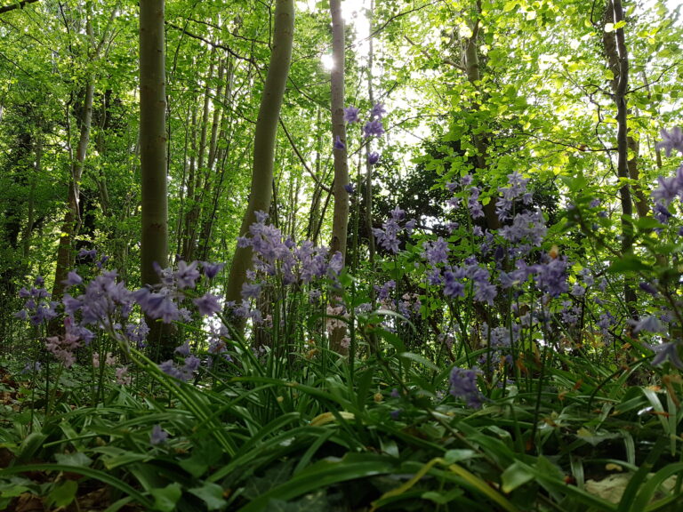
At its core, the Cambridge Green Belt was established to prevent surrounding villages from being swallowed up by the city, places like Grantchester, Coton and Teversham. It also aims to encourage the reuse of land within the city itself, rather than pushing development endlessly outward. In Cambridge, this has worked relatively well. We have little derelict land, and redevelopment has often taken place on previously developed sites, such as older commercial buildings on the Science Park being replaced rather than building new offices in open countryside beyond the A14.
Cambridge’s Green Belt also has a distinctive additional purpose: to protect the setting and special character of the historic city. This is particularly important to the west of Cambridge, where views, landscape and heritage are tightly interwoven.
Green Belts don’t stop development, they redirect it
It’s important to be clear about what Green Belts are not designed to do. They are not meant to prevent development altogether. Instead, they are intended to deflect development elsewhere, typically to new towns beyond the Green Belt that are large enough to be genuinely self-sustaining, with their own jobs, services, cultural life and identity.
Classic examples include Stevenage in relation to London, or Telford in relation to Birmingham.
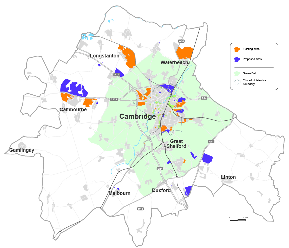
If England had a truly strategic planning system, that’s how the Cambridge area might be approached too. Places like Ely, Haverhill, Royston or Huntingdon could play that new-town role. Instead, we operate almost entirely within a local planning framework. The result, over the past 20 years, has been a series of large developments placed just beyond the Green Belt boundary.
These include:
-
Northstowe (10,000 homes planned, around 2,000 built)
-
Waterbeach (11,000 planned, around 300 built)
-
Greater Cambourne (22,000 planned, around 7,000 built)
When we talk about Greater Cambourne, this includes Cambourne as it exists today (Lower, Great, Upper and West Cambourne), alongside further planned development to the north of the town and the Bourn Airfield site. The number of homes already built reflects the current Cambourne settlement as most people know it.
All of these developments sit to the north of Cambridge, while much of the region’s new employment growth is happening to the south. That imbalance has consequences.
Pressure moves south
Major science and biomedical campuses south of Cambridge have understandably argued that housing should be located closer to jobs. As a result, proposals are now emerging for development in open countryside to the south of the city, beyond the Green Belt.
One scheme, next to the Wellcome Genome Campus at Hinxton, already has permission for 1,500 homes, though construction has not yet begun. Another, far larger proposal, is for Grange Farm, identified in the latest draft of the Local Plan. This would see around 6,000 homes built across a wide swathe of countryside between the A11, the A1307 and the Roman Road.
The scale here is critical. Grange Farm is too large to be a village, yet too small to be a self-sustaining new settlement. People living there may be close to employment, but would likely need to travel elsewhere for many other aspects of daily life. The risk is that it becomes a vast suburb in the countryside, neither town nor village, and difficult to integrate sensitively into the landscape.
It also raises the question of whether the site has been chosen through careful, long-term planning, or whether housing numbers lost elsewhere, such as the stalled redevelopment of the Cambridge sewage works, have simply been displaced onto the nearest available land.
So is the Green Belt being protected?
Not entirely.
At the same time as development is being pushed beyond the Green Belt in some areas, other parts of the Green Belt have already been redesignated to allow Cambridge itself to expand. Cambridge Airport and its surroundings were once Green Belt land; that designation was removed to enable development of around 10,500 homes, with roughly 1,500 built so far. The same is true of the large developments on the north-western edge of the city, where 8,000 homes are planned.
The latest Local Plan also proposes using Green Belt land to enable further expansion of the Cambridge Biomedical Campus and the Babraham Research Campus.
What we are seeing, then, is a blend of strategies: some protection of the Green Belt, some new settlements beyond it, and some direct expansion into it. Faced with intense development pressure but limited planning powers, local authorities are trying to balance competing demands.
Whether they have got that balance right is not a question with an easy answer. But it is a question that deserves informed public debate.
This blog was written during the local plan consultation period which has now closed as of 30 January 2026.
You can find out more at: www.greatercambridgeplanning.org/local-plan